10 Best Hiking Trails in the Blue Mountains for Nature Lovers
Have you ever wondered which trail will leave you breathless for the right reasons? I ask that because the blue mountains hold so many views and surprises that one walk can change how you see the whole region.
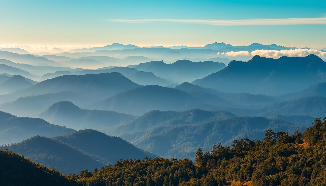
I share my personal shortlist of day walks and why these trails keep drawing me back: dramatic sandstone cliffs, ferned gullies, and that eucalyptus scent that marks this national park.
This short guide sets expectations for timing, terrain, and the kind of waterfalls or cliff-edge panoramas you can expect on each outing.
I also point out who each route suits—first-timers, photographers, families, or strong hikers—so you can match the hike to your energy and time.
Practical note: trains often beat driving to towns like Katoomba, some tracks close after storms, and packing layers and water keeps a day memorable for the right reasons.
Start here: how I picked the best hikes in Blue Mountains (and what to expect)
To assemble this guide I focused on day-friendly tracks that showcase iconic viewpoints and waterfalls.
I looked for routes that give the classic blue mountains experience: sweeping valley outlooks, ferned gullies, cliff overhangs, and easy waterfall encounters without technical gear.
I rely on repeats of favourites such as the Grand Canyon and Wentworth Falls, plus official track notes. That helps me balance easy, moderate, and stair-heavy options so you can match walk difficulty to your available time.
Logistics matter: I chose trails close to train stations (Katoomba, Leura, Blackheath), simple start/finish points, and clear parking where possible. I also flag crowd hot spots like Echo Point so you can avoid peak times.
Finally, check current track status at the NSW National Parks site before you go. Flooding, landslides, and bushfire closures change plans quickly, and a quick check saves you time and keeps the day enjoyable.
Prince Henry Cliff Walk: Katoomba Falls to the Three Sisters and Echo Point
I prefer to park at Katoomba Falls Reserve and start the prince henry cliff route from there; parking is often easier and free by car, which saves time before walking. From that point the track stays near the clifftop and links a string of lookouts that deliver steady views along the way.
The lookouts stack up nicely: Katoomba Falls Lookout, Orphan Rock Lookout, Witches Leap Lookout, then the Katoomba Cascades and the Duke and Duchess of York lookout before you reach Echo Point and the Three Sisters. The pace is low-effort but rewarding, with a wide path and minimal stairs for most of the distance.
Timing and distance: allow about 45–75 minutes one way depending on stops. Optional detours toward the falls may be closed, so check current track status before you plan that side quest.
This is family-friendly: benches near the cascades make good rest stops, but bring grippy shoes for damp patches and short stair sections. Early morning or late afternoon eases crowding at Echo Point and changes the light—late haze often deepens the blue mountains tones and makes photos pop.
Return options: retrace your steps to the Katoomba Falls car park or link with nearby paths to finish where you parked. Echo Point has basic amenities, so pace your stops and soak in each lookout—this track is all about the views.
Grand Canyon Track from Evans Lookout: ferny gullies, waterfalls, and canyon walls
I start this loop at the Grand Canyon car park on Evans Lookout Road and head anti-clockwise. The route falls steeply into a shaded canyon, then returns with the hardest climb saved for last.
The track is about 6–6.3 km and takes roughly 3–4 hours at a steady pace. Expect cool air, giant ferns, trickling streams, and sandstone walls that give the canyon a primeval feel.
Stone stairs and rockwork lead down to the creek; the descent is steady and the return is lung‑busting. I recommend grippy shoes, moderate fitness, and enough water and snacks to keep energy up.
There’s a short slot canyon detour near the bottom. It isn’t signed, so only explore as far as you’re comfortable, then rejoin the main trail and the stairs back to the rim.
Why I like it: starting anti-clockwise means Evans Lookout views arrive as a reward at the end. If short on time, pop up to the lookouts for sweeping blue mountains vistas before you drive away.
Safety note: watch slippery stones after rain and expect damp shoes from creek crossings.
Wentworth Falls circuit: Grand Stairway, Fletchers Lookout, and Princes Rock
The Wentworth Falls circuit packs dramatic cliff views and a roaring waterfall into a short, steep loop. The route links Wentworth Falls Lookout, Fletchers Lookout, the Grand Stairway descent, and Princes Rock for a compact experience.
The loop is roughly a 2.6 km distance but it is steep and stair-heavy, so expect lots of stairs and a good leg workout. Wear shoes with traction and mind your knees on the descent.

I break the circuit so you hit the best lookouts quickly: a close view at Fletchers, the thunder of the waterfall from below, then Rocket Point and Princes Rock for sweeping valley views. Allow extra time for photos; the angles change as you move.
Park at Wentworth Falls car park and aim for an early start to avoid crowds. Some sections have been closed since 2023, so check current track status. If parts are shut, a short out‑and‑back to the open lookouts still gives the drama.
Safety note: stay behind rails, watch slippery steps, and expect spray near the base pools. For a quick, high-impact outing in the blue mountains, this loop is my go-to when time is tight.
Porters Pass and Colliers Causeway via Centennial Glen
From Centennial Glen I drop into ferned gullies that feel like a secret rainforest before the cliffs reveal wide valley views.
I map the circuit to start at the small car park, descend the hand-carved stairs by stepping cascades, then follow the track under soaring sandstone cliffs toward Porters Pass and Colliers Causeway. The route threads rainforest and open ledge, so the scenery changes fast.
A short ledge detour leads to a petite slot canyon and a hidden plunge pool. The junction is unsigned; the ledge walk is brief but needs steady footing. After rain the temporary waterfalls swell and ferns gleam, which is when this loop feels most alive.
Climb Fort Rock at the end if you have time—the sunset over Kanimbla and Megalong valleys is a dramatic finale. I prefer anti-clockwise so the stair climbs come later and feel earned, and street parking near Centennial Glen keeps logistics simple.
Expect uneven, sometimes slippery surfaces. Move with care and patience, and you’ll walk away feeling like you earned those quiet canyon views.
Hanging Rock via Burramoko Ridge Fire Trail (Baltzer Lookout)
I like an easy ridge walk that saves its drama for the last steps. The Burramoko Ridge fire trail runs mostly flat and wide, so you can set a steady pace and enjoy the wind moving across the gums.
The round trip is about 10–11.3 km and takes roughly 2.5–3 hours depending on stops. Start near Ridgewell Road/Baltzer Lookout trail start, a short drive from Blackheath with simple parking by car.
At the end, the ridge opens to unfenced cliff edges and a narrow gap to reach Hanging Rock. The lookouts give broad, layered views of valley geometry rather than waterfalls or ferns.
Safety first: there are no rails at the cliff, so move carefully, secure loose items, and avoid the small jump unless you are confident. Wind gusts make footing tricky; pack a warm layer for the exposed cliff line.
Why I like this hike: it’s an easy way to earn a massive wow moment without a steep climb. Pace yourself, pick the best light near the end, and respect the drop—those raw rock platforms reveal their scale with each step closer to the edge.
Clifftop Track between Govetts Leap and Evans Lookout
I often pick this walking track when I want a single, approachable day that still feels epic.
The route is roughly 6 km return and takes about 2–3 hours at a steady pace. Start at Govetts Leap; expect a few stairs early on, then the trail levels for long, relaxed escarpment walking.
Why I recommend it: you get continuous Grose Valley views and two world-class lookouts—Evans Lookout and Leap Lookout—without technical sections. The path is well-defined, so mixed-experience groups do fine here.
I like doing this as a return so the light on the cliff faces changes and the vistas feel fresh both ways. Pair it with the Grand Canyon loop for a longer day if you have time.
Practical tips: park at either end where amenities are available and start early on weekends. Wear grippy footwear; some sandy or damp patches can be slippery. Pause often at viewpoints to soak the scale in—this is wide-angle photography territory, not a rush to the finish.
Pulpit Walking Track from Govetts Leap to Pulpit Rock
Set out from Govetts Leap Lookout and follow the rim as the valley unfolds toward a dramatic rock platform. The walking track undulates gently, with frequent lookouts along the way that invite short breaks and photos.
The route is about 7 km return and usually takes 2–3 hours at a relaxed pace. It’s an out-and-back, so pacing and daylight planning are simple: you return the same way you came.
Along the trail you’ll pass creeks, small waterfalls after rain, and varied rock formations. Some sections can be sandy or slippery, so I wear grippy shoes and slow down on descents.
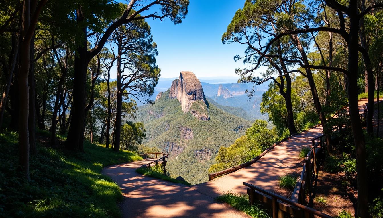
The payoff at the end is worth it: Pulpit Rock sits like a floating ship over the canyon and gives different angles of the valley from its platforms. It’s wind-exposed, so bring a snack and water and sit where you feel safe.
Compared to the clifftop track, this trail has fewer stairs and a clearer focus on a single destination. I like early or late starts here for moodier light and fewer people. Short detours to small lookouts along the way keep the walk lively, not just about the end.
South Lawson Waterfall Circuit: a photogenic multi-falls loop
This short loop around South Lawson threads multiple waterfalls through a ferned, mossy pocket of forest. I start near 95 Honour Avenue, Lawson, where parking is simple and the trailhead is obvious.
The circuit is about 3–3.5 km and takes roughly 1.5–2 hours if you pause at each cascade. I budget a few minutes at Junction Falls and other drops to photograph textures and listen to the water.
Why I like it: the grade is easy, the walking is relaxed, and the creekside track feels intimate rather than epic. Ferns and mossy logs make the atmosphere feel rainforest-like after rain.
I wear grippy shoes because the path gets muddy and damp timber can surprise you. This loop is dog-friendly on leash, which is a rare perk here.
For families and mixed groups: short gaps between sights keep kids motivated. Pack a small towel if you plan to touch the water or sit on rocks for photos.
When cliff tops are fogged, I head this way for close-up waterfall views and gentle hiking without the crowds.
Jenolan River Walk and Blue Lake: cave country cooldown
After a cool cave tour, I usually opt for a riverside stroll that slows the pace and soothes the ears.
The walk is an easy ~2.6 km return trail that takes about 60 minutes at a relaxed pace. The route hugs the water most of the way, with a suspension bridge and small waterfalls that keep the soundscape lively.
The turquoise of Blue Lake is unforgettable and the track climbs briefly near the end to Carlotta Arch for a new angle on the limestone. It’s family-friendly, shaded, and ideal as a half-day option when you pair it with a guided cave tour.
I drive here from the Upper Mountains—about 90 minutes by car from Blackheath—so I plan this as a gentle day activity. Check road conditions and park or track status before you go; weather and rockfall can alter access.
Bring water and a snack, and consider camping or nearby accommodation if you want more trail time the next day. Compared with cliff-focused routes, this one is quieter and all about water, limestone, and a soft finish to a busy hiking week.
Coachwood Glen Nature Trail: a short, serene rainforest loop
Coachwood Glen feels like a secret; the loop is small but dense with ferns, moss, vines, and the soft sound of water. I step off Megalong Road near Blackheath and I can be on the trail within minutes for a quick reset.
This ~600 m loop takes about 20 minutes at a gentle pace and is ideal when I want a short walk that still delivers rainforest textures. A small roadside parking area and a clear sign mark the Coachwood Glen Nature Trail, so it’s easy to pull over and stretch your legs.
The vibe is cool shade, soft forest floor, and tiny stream crossings that make the place feel canyon-like despite its calm grade. I bring steady shoes—roots and damp patches can be slick—and a camera for close-up shots of moss and ripples.
Why I stop here: it balances a day heavy on cliff viewpoints with a peaceful, grounded forest interlude that suits families and anyone after a short nature hit. Tread lightly; the moss and understory are fragile and part of what makes this loop special.
Planning your Blue Mountains hiking day: transport, parking, and logistics
I always decide first whether I’ll drive or catch the train—each choice changes how many routes I can link and the day I can build.
By car, I can chain multiple trailheads and carry extra gear. One main road runs west from Sydney and makes towns easy to reach. Remember Echo Point often has paid parking, so I aim for Katoomba Falls Reserve when I want easier, often free access to clifftop sections.
By train, the Opal card gets you to Katoomba or Leura and keeps the day simple. Use local buses or the Explorer Bus to bridge trailheads and avoid long backtracks.
Packing: day backpack, refillable water bottle, snacks, camera, sunscreen, sunglasses, and sturdy boots that grip wet stone and dirt. Check the national park site or apps for current track status—closures change plans fast.
For overnight options I pick hostels in Katoomba or try basic camping if I want a sunrise start. Fuel up at town cafes, secure your car, and don’t leave valuables visible at parking areas.
Simple day plans: Clifftop Track plus a short nature loop for a relaxed 3–4 hour day, or combine Grand Canyon with a nearby lookout for a full day that balances distance and time without excess backtracking.
Best time to hike, safety tips, and current track conditions
Picking the right hour can turn a good trail into a memorable experience. Mornings are cooler and quieter; late afternoon gives golden light and deeper valley tones. Cloud and mist often make the blue mountains vista more dramatic, so don’t fear a touch of fog.
Always check NSW National Park alerts before you leave. Floods, landslides, and bushfire closures happen, and some routes like the Wentworth Falls Grand Stairway may be partially restricted.
I tell someone my plan and carry extra water and snacks even for a short day. In remote gullies phones can lose signal, so I pack a PLB or personal locator device and download offline maps.
On the track: wear shoes with solid tread, stick to signed routes, and slow down on wet stairs and exposed ledges. Have a Plan B — nearby alternatives often deliver similar views if your first choice is closed.
Prepared hiking keeps the day joyful and safe, and it helps you come back for more of this national park’s quiet moments.
Conclusion
I wrap this guide with a simple roadmap to help you pick the next outing by mood.
I recap the mix: shaded canyon trails like Grand Canyon, cliff-edge lookouts such as Evans Lookout and the Three Sisters, ferned creeks at Centennial Glen, and quieter ridge lines at Porters Pass and Colliers Causeway.
Start easy—try a clifftop walk for broad views, then graduate to stair-heavy loops when you want solitude and a bigger workout. Add a rock-forward finale at Hanging Rock once you’re comfortable with exposure.
Use this guide to match time and energy to the right trail so your day ends satisfied, not spent. Pick a date, pack your bag, and make a hike blue routine part of your life.